Your reliable partner for surveying jobs
We are an expert team of surveyors with many years of experience and the latest technologies, dedicated to quality and accuracy in every step.

QUALITY
Quality is our core value and we pride ourselves on our commitment to delivering excellent solutions, because we believe that quality should never be compromised. This is reflected in everything we do, because we want our clients to be completely satisfied and proud of the results we achieve together.

reliability
Precision and accuracy play a key role in geodetic work, therefore our surveyors are trained to be meticulous and consistent, because we believe that quality is measured in small details. Your trust is our greatest reward and we work hard to justify it.

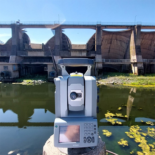
technology
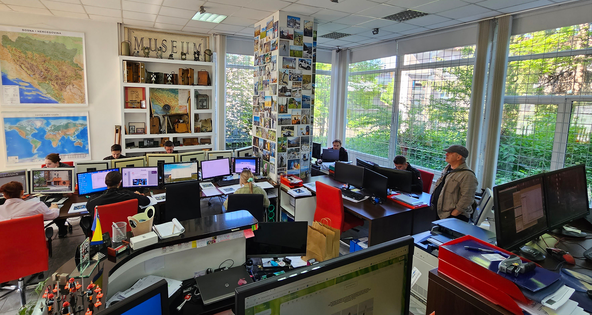
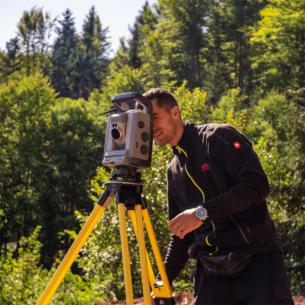
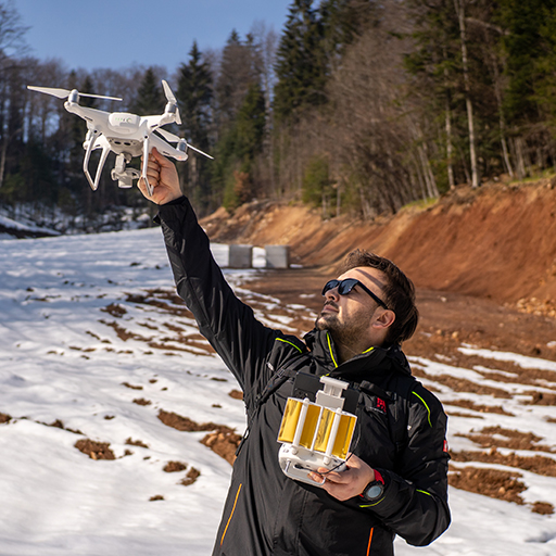
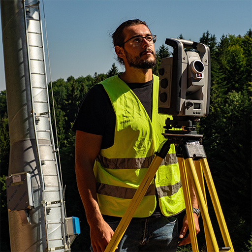
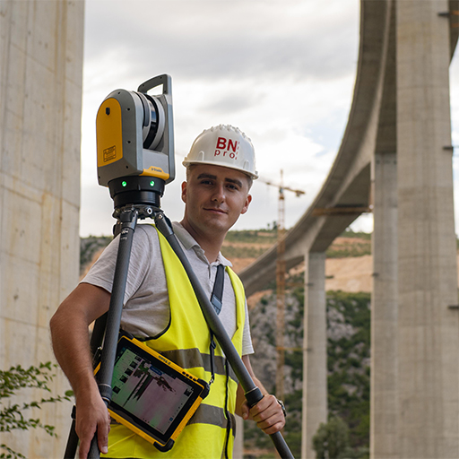
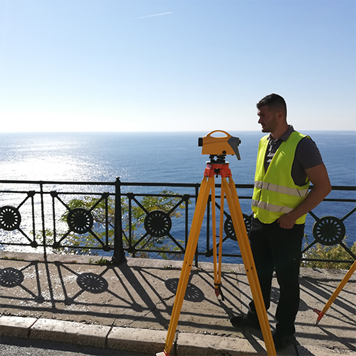
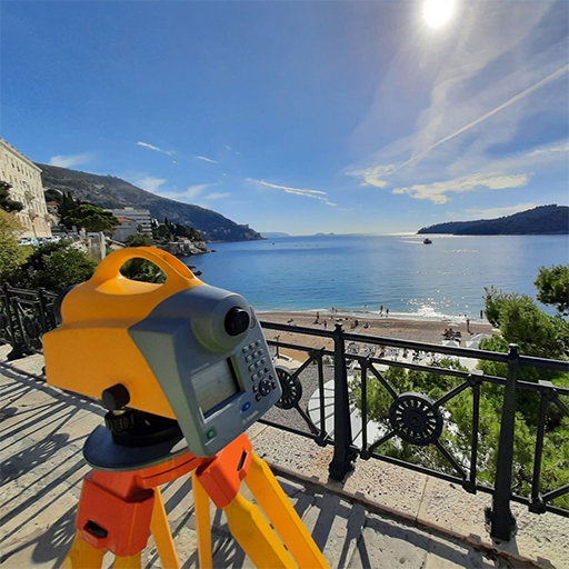
Our firm invests in the latest surveying technology and high-quality equipment to ensure that every project is handled with the greatest efficiency. Our team uses advanced tools and software to collect and interpret data, thus ensuring fast and reliable service.

expertise
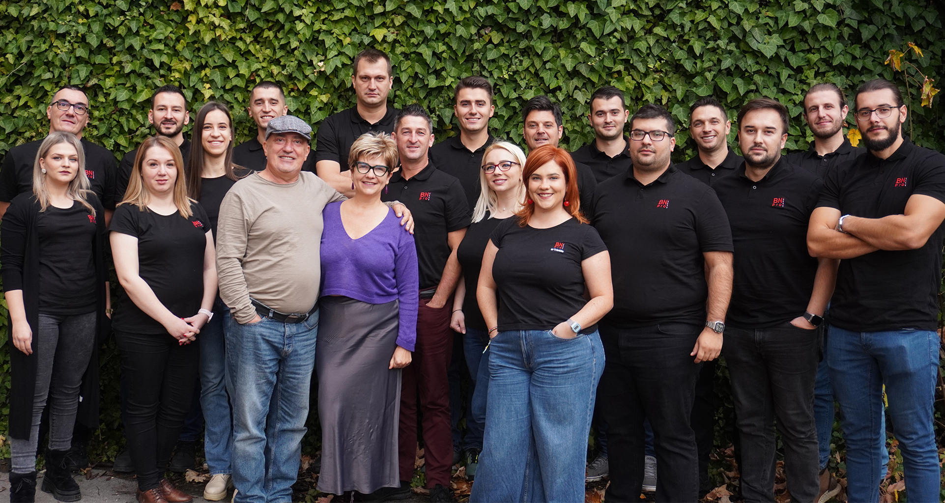
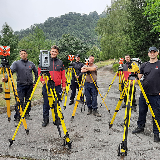
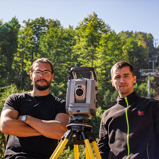
Our team consists of 21 experienced experts who together possess a wealth of knowledge and experience. Their commitment to quality and innovation ensures that every task is thoroughly analyzed and executed with attention to detail.
About us
BNpro d.o.o. is a surveying company founded in Sarajevo in 2008 with the vision of providing top geodetic services to our clients. Through many years of business, we have gained the trust of numerous clients thanks to our dedicated work, precision and speed of project execution.
Services
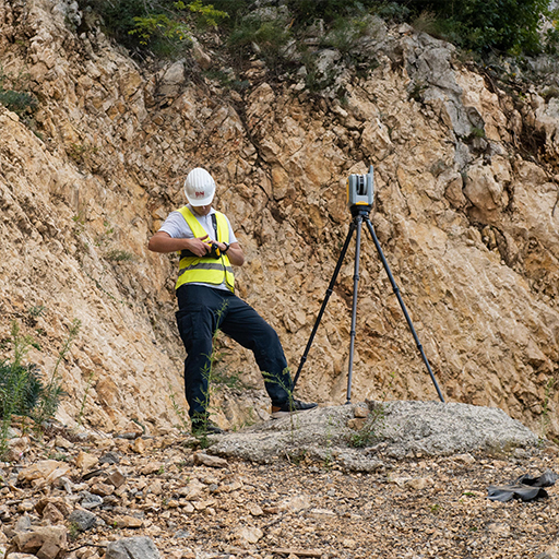
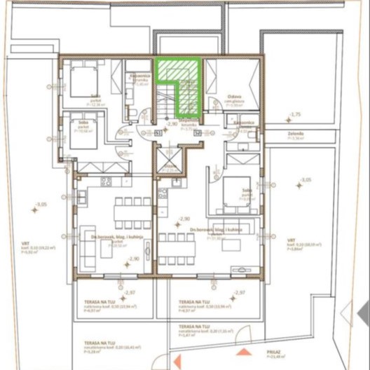
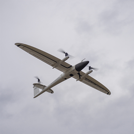
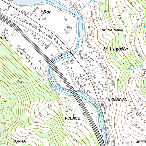
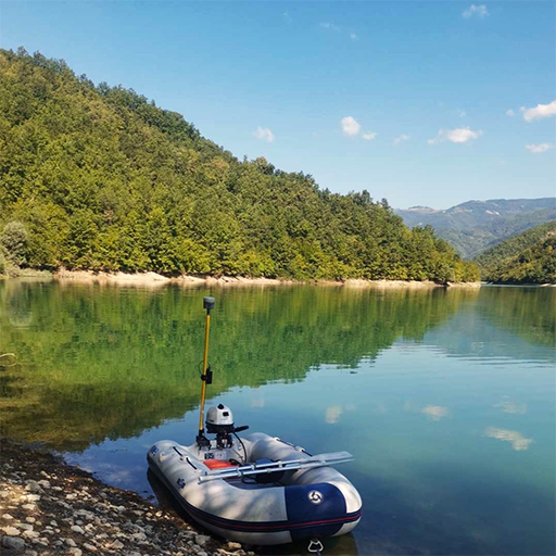
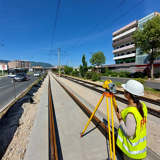
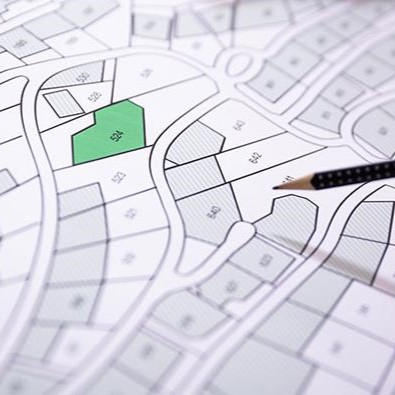
We offer a wide range of services, including geodetic surveying, topographic creation maps, precise leveling, aerial photogrammetry, 3D laser imaging and much more.
Products
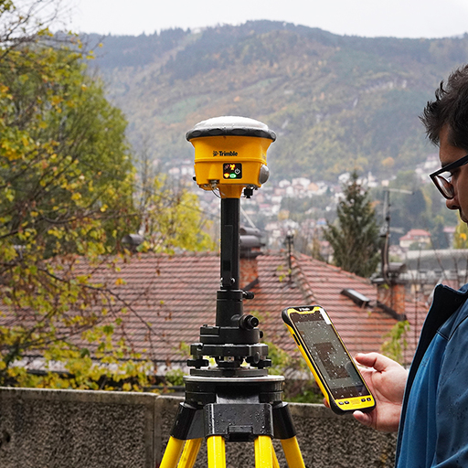
BNpro d.o.o. is the official representative of Trimble Geospatial instruments for Bosnia and Herzegovina, but in addition to Trimble, we also offer other surveying equipment and accessories, such as rods, prisms, augers, markers, etc.

Projects
Professional geodetic supervision
- Supervision of the highway construction project on the Vc corridor on the section Tarčin-Konjic, sub-section Tarčin-Ivan
- Services of a professional surveyor on the highway construction project on the Vc corridor, Tarčin-Vlakovo section, Butila-Vlakovo-Lepenica subdivision from 8/2013 to 8/2015.
- Consulting services for construction supervision – project: construction of the highway on the Vc corridor, section Poprikuše-Zenica North (Donja Gračanica), subdivision Vranduk Ponirak
- Geodetic supervision of the execution of preparatory works for the construction of Block 7 for the needs of TPP Tuzla
- Reconstruction of the tram line between Ilidža and Muzej stations
- Reconstruction of water supply networks and modernization of KS pumping units and wells on the project GrCF Sarajevo Water Supply Project – Tranche II
- Geodetic supervision and revision of project documentation on the construction of Kobilja Glava Tunnel
- Supervision of geodetic recording of 3D geodetic situations of main roads in FBIH
Creation of main and conceptual projects and visualization
- Development of the project of the Katun object, Štinja lokva sports field, fence around the Umoljani mosque, Obla Brda, Kramari, Ozimina, Šabići and Brutusi wells, fountains in Trnovo, watering holes and fountains in Dugi polje, springs in Ostojići
- Drafting of the conceptual project of the tourist and sports camp settlement Bjelašnica, Municipality of Trnovo
- Visualization of the conceptual project of the future cable car “Park Smetovi”
- Video presentation services of the Bentbaša-Kasarna Jajce inclined lift and video presentation of the route from Hotel Pino Nature to Jarčedol
- Creation of a 3D model of the Počitelj bridge
- As-built project: Section M17 Blažuj – Tarčin
Geodetic surveys
- Geodetic survey services covering the campus for the purposes of making changes to the master plan
- Geodetic surveying services in the area of Bjelašnica and Igman with elaboration, recording of ski lift shafts and the position of coil batteries at the location of the Ski Center Bjelašnica and Igman
- Geodetic surveying services in the regulated course of the Miljacka river for the purposes of creating a hydraulic model
- Creation of up-to-date geodetic situations in the state coordinate system with horizontal and vertical representation for the needs of the Municipality of Centar Sarajevo for the period 2013-2015, 2017-2019, 2020-2022.
- Surveying of existing main roads for registration purposes for the Donji Vakuf-Turba, Kolo-Posušje, Posušje-Široki Brijeg sections
- Surveying for the needs of the “Kakanj” TE Branch
- Geodetic survey of coal at the Hrasno depot and geodetic survey of the slag and ash landfill
- Geodetic survey of the slag and ash landfill on Turbići and creation of a situational map of the landfill on a scale of 1:1,000
- Geodetic survey of the Kakanj TPP coal stock and calculation of the volume of deposited coal in three separate parts of the total area of approx. 40,000m2 in four periods of the year at the Hrasno Kakanj depot
- Geodetic survey of existing power facilities of MV lines for the needs of the Bihać branch of electric distribution by business units of distribution, i.e. municipalities of the Unsko-San canton
- Control geodetic surveying of mineral deposits under the jurisdiction of the Una-Sana canton and elaboration of mined amounts of mineral resources in 12 localities
- Geodetic surveying of the dam, scanning and creation of a 3D model of HPP Jablanica for the needs of “Hydroelectric Power Plant on the Neretva” Jablanica
- Provision of geodetic surveying services at the “Duboki Do” deposit in Rakovica near Sarajevo
- Staking out and leveling the route and creating the derived state by meters
- Staking out, controlling and leveling inspection manholes and culverts on the route of the highway
Production of boards with house numbers and address register
- Creation and installation of signs with house numbers and street names in the Olovo municipality
- Providing the service of creating an address register for the Municipality of Vogošća – Phase II
- Creation of the address register for the area of Olovo Municipality
- Development of a project for marking inhabited places, streets/squares/neighborhoods with names and buildings with house numbers, with the development of a register of spatial units in the area of the Vogošće Administrative Region
Drafting of the water resource study
- Preparation of the elaboration of the determination of the boundaries of the water property along the Bioštica river (watercourse of the II category)
- Elaborate on the determination of the boundary of the water property on the Stučanica river section (category II watercourse)
Data disclosure services for public inspection
- Services for public inspection of land survey and cadastral classification data for the Municipality of Ilijaš
- Services for public inspection of survey data and land cadastral classification for the Municipality of Kiseljak
Harmonization
- Data reconciliation services between the cadastre and the land registry
- Reconciliation of real estate data of the cadastre and land registry PHASE IV, VI, VII, VIII, IX
- Copying-scanning service of land registers in municipal courts in FBIH PHASE II
Cartography
- Formation of the basic topographic database FBIH scale 1:10 000
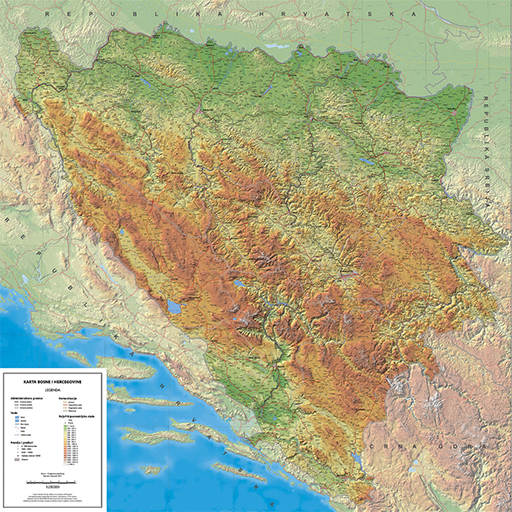
- Production and printing of a map of Bosnia and Herzegovina on a scale of 1:250,000
- Reproduction of map bases
- Determining the parameters of coordinate transformation from the ETRS89 coordinate system to the national coordinate system – performing field observations
Geodetic works - ski slopes and ski lifts
- Geodetic monitoring of the construction of the BX elevator in Bjelašnica
- Geodetic surveying and staking out of buildings in the preparatory phase for the construction of vertical transport with an artificial snowmaking system in Bjelašnica
- Geodetic surveying and cadastre preparation of the communal water supply network Bjelašnica
- Geodetic survey of ski slope 5a for the purposes of homologation of the slope
- Surveying of the route of the newly planned ski lifts K1 and K2
- Services of measurement, recording of longitudinal and transverse profiles of ski slopes in Bjelašnica with preparation of reports
- Services of aerial photogrammetric surveying of a wider area of trails on Bjelšanica for the creation of a spatial plan
Technical observation
- Technical monitoring of the Sniježnica dam with interpretation of the results, for the needs of the “Elektrodistribucija” Tuzla Subsidiary 2016-2023.
- Technical monitoring of the “Modrac” dam – two series of monitoring per year, summer/winter 2014-2023.
- Technical inspection of dams and reservoirs Vidar and Hazna in Gradačac in 2013 and 2015.
- Geodetic observation of the Kukovi landslide for the needs of “Hydroelectric power plant on the Neretva” Jablanica
- Technical monitoring of the KUKOVI landslide, performing geodetic works on the observation of “Kukovi” with the preparation of studies on the observation of HPP Jablanica
- Geodetic survey of HPP Jablanica, HPP Grabovica and HPP Salakovac dams
Geodetic-hydrographic surveys
- Elaboration of geodetic-hydrographic surveying of the bottom and shores of the reservoir “Modrac” with measurement data processing
- Control of sediment measurement in the Jablanica HE Jablanica storage basin and participation in the preparation of the report
- Control measurement of sediment in the storage basin of HPP Salakovac – recording with a single-beam depth gauge EHOSONDER with preparation of a recording report
Risk maps
- Collection of terrestrial data needed for hydraulic modeling and analysis to create hazard maps and flood risk maps for BIH – PHASE 1 and 2
Restoration of the geodetic network
- Renewal of the geodetic network of Travnik as part of the project “Systematic update of cadastre data for part of the municipality of Travnik”
- Realization of the Sapna geodetic network renewal project
- Basic geodetic works – Leveling of high accuracy NVT III
Reambulations
- Elaborate on the updating of geodetic foundations with vectorization and creation of a database for the needs of creating the UP “Vitikovac I”
- Elaborate on the updating of geodetic foundations with vectorization and creation of a database for the needs of creating UP “SOLARIS”
- Elaborate on the updating of geodetic foundations with vectorization and the creation of a database for the needs of creating the RP “Pofalići-Ciglane”
- Elaborate on updating geodetic foundations with vectorization and creating a database for the needs of creating the RP “Alipašina-Koševo”
- Elaborate on the updating of geodetic foundations with vectorization and creation of a database for the needs of creating the RP “Sedrenik”
- Elaborate on the updating of geodetic foundations with vectorization and creation of a database for the needs of creating the RP “Blažuj”
- Elaborate on updating geodetic foundations with vectorization and creation of a database for the needs of creating RP Vitikovac – Location of connection LOT 2C with Safeta Zajka Street
- Elaborate on updating geodetic foundations with vectorization and creating a database for the needs of creating the RP “City Park Marijin Dvor – Hastahana”
- Elaborate on updating geodetic foundations with vectorization and creating a database for the needs of creating a spatial plan for waste management RCUO Smiljevići
- Elaborate on updating the geodetic foundations with vectorization and creating a database for the needs of creating the RP “Alipašin most V”
- Elaborate on updating geodetic bases with vectorization and creating a database for the needs of creating the RP “RTV”
- Elaborate on updating geodetic foundations with vectorization and creating a database for the needs of creating the RP “Travnjak”
- Elaborate on the updating of geodetic foundations with vectorization and creation of a database for the purposes of creating the RP “Riverina – Components”
- Elaborate on updating geodetic foundations with vectorization and creating a database for the needs of creating the UP “Bjelašnica-Babin do”
- Elaborate on the updating of geodetic foundations with vectorization and creation of a database for the needs of creating UP Residential settlement – South slope of Mojmilo hill – Dobrinja
- Elaborate on updating geodetic foundations with vectorization and creation of a database for the needs of creating RP “Peyton”
- Elaborate on the updating of geodetic foundations with vectorization and creation of a database for the needs of creating the RP “Savića brdo”
- Elaborate on updating geodetic foundations with vectorization and creation of a database for the needs of creating RP “Reljevo”
- Elaborate on the updating of geodetic foundations with vectorization and creation of a database for the needs of creating the UP “Memorial Complex Tunnel D-B”
- Elaborate on the updating of geodetic foundations with vectorization and creation of a database for the needs of creating the RP “Azići II”
- Elaborate on updating the geodetic foundations with vectorization and creating a database for the needs of creating the RP “Alipašin most V”
- Elaborate on the updating of geodetic foundations with vectorization and creation of a database for the purposes of creating the UP “Sports Recreation Center Dobrinja”
- Elaborate on the updating of geodetic foundations with vectorization and creation of a database for the needs of creating UP “Congresni centar Sarajevo”
- Elaborate on the updating of geodetic foundations with vectorization and creation of a database for the needs of creating the RP “Srednje”
Expropriations
- Services and additions to the Elaboration on expropriation at the location of the I transversal – Municipality of Novo Sarajevo on part of the land owned by Željeznica FBIH
- Elaboration of expropriation, reconstruction of the intersection in Jelah, Municipality of Tešanj
- Expropriation elaboration services for the reconstruction of Stupska Street
- Expropriation preparation services for the construction of a pedestrian path in Uglješe Uzelca Street
- Expropriation drafting services for the construction of the GLD8 cabin cableway Vrelo Bosne – Golo Brdo
- Surveying services in expropriation procedures at the location of the road – I transversal – Municipality of Novo Sarajevo
- Services for the preparation of expropriation studies for two bus stops in Šamin gaj
- Services for drafting the expropriation study of HPP Vranduk
- Preparation of the supplement to the expropriation study in connection with the local road that follows the “A” ramp of Stupska petlje
- Expropriation drafting services at 5 disputed locations on the XII transversal with staking
Cadastre of communal devices
- Geodetic surveying and elaboration of geodetic surveying of the cadastre of communal devices on several objects
- Recording the map of underground installations in the area of Sarajevo Canton for the needs of BH Telecom d.d. Sarajevo
- Cadastre recording of underground installations in the area of Tuzla Canton
- Cadastre recording of underground installations in the locality of Ahatovića
- Recording of communal devices of the water network laid in the wider area of the Municipality of Cazin
- Geodetic survey of existing power facilities in the area of Sarajevo Canton for the needs of JP Elektroprivreda d.d. BIH
- Cadastre recording for the purposes of documentation of the state of affairs in the area of Sarajevo Canton
- Geodetic recording of underground installations and creation of a geodetic study for the needs of the cadastre of underground installations and transfer to the collective cadastre of municipal water
Photogrammetry
- Provision of photogrammetric terrestrial recording of uncovered parts of the synagogue “II Kal grandi” – BKC Sarajevo
Our team
We are an expert team of surveyors with many years of experience and the latest technologies, dedicated to quality and accuracy in every step.